The Seagrass Health and Abundance Study was undertaken by Natura Pacific in 2012 to develop a Seagrass Monitoring Program for the Gold Coast. The aim of the project was to develop cost effective methods for monitoring seagrass habitats as well as improve the understanding of how these habitats functioned and what may be threatening their survival in the Gold Coast Local Government Area (LGA). The project also provided local government and technical officers training in appropriate and up-to-date monitoring methods and data entry procedures which could be implemented into the future. All information collected during the project period could then be made accessible and added to over time in order to better manage this important natural resource into the future.
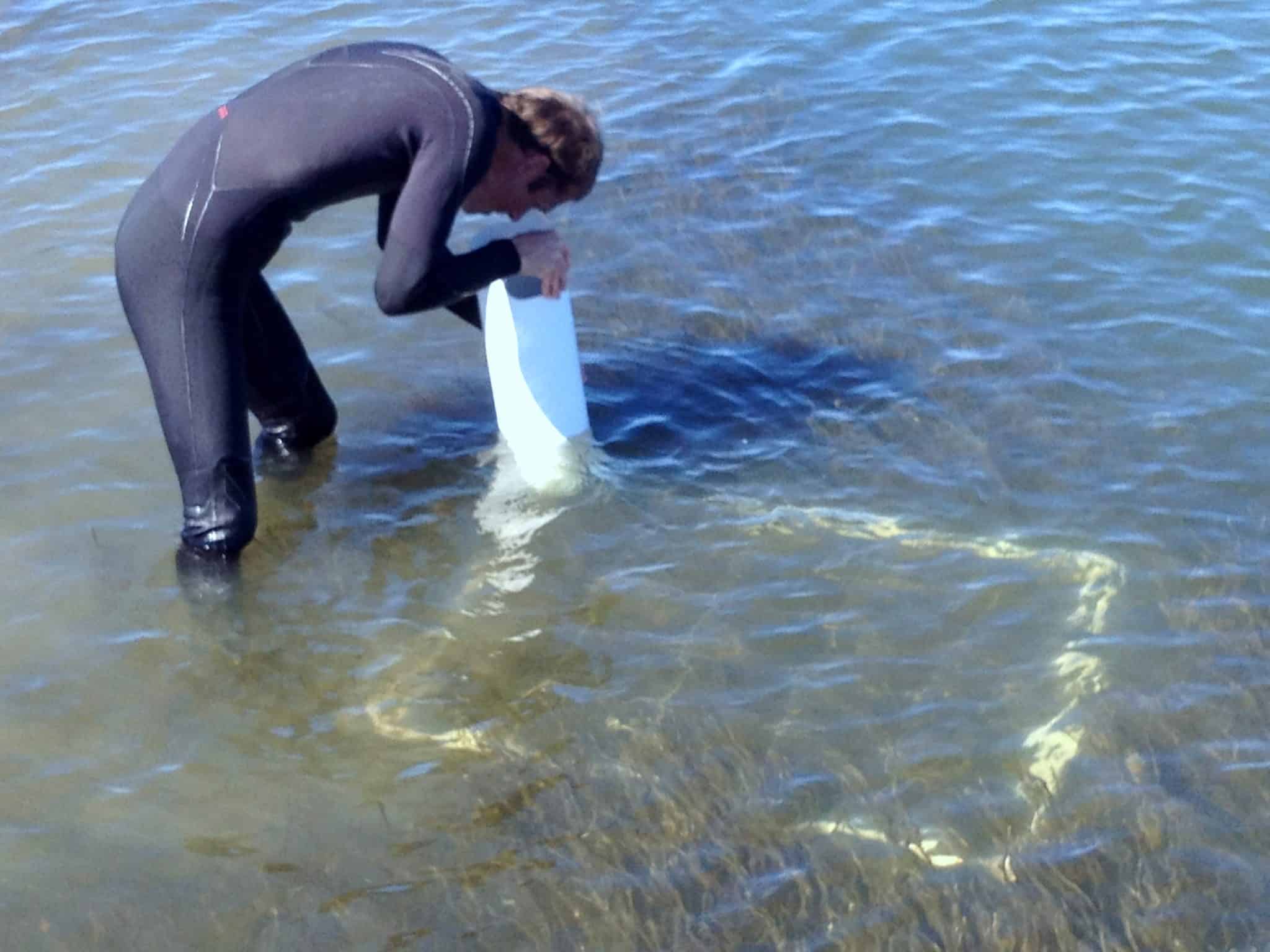
Use of bathyscope to assess seagrass patches at Sovereign Island
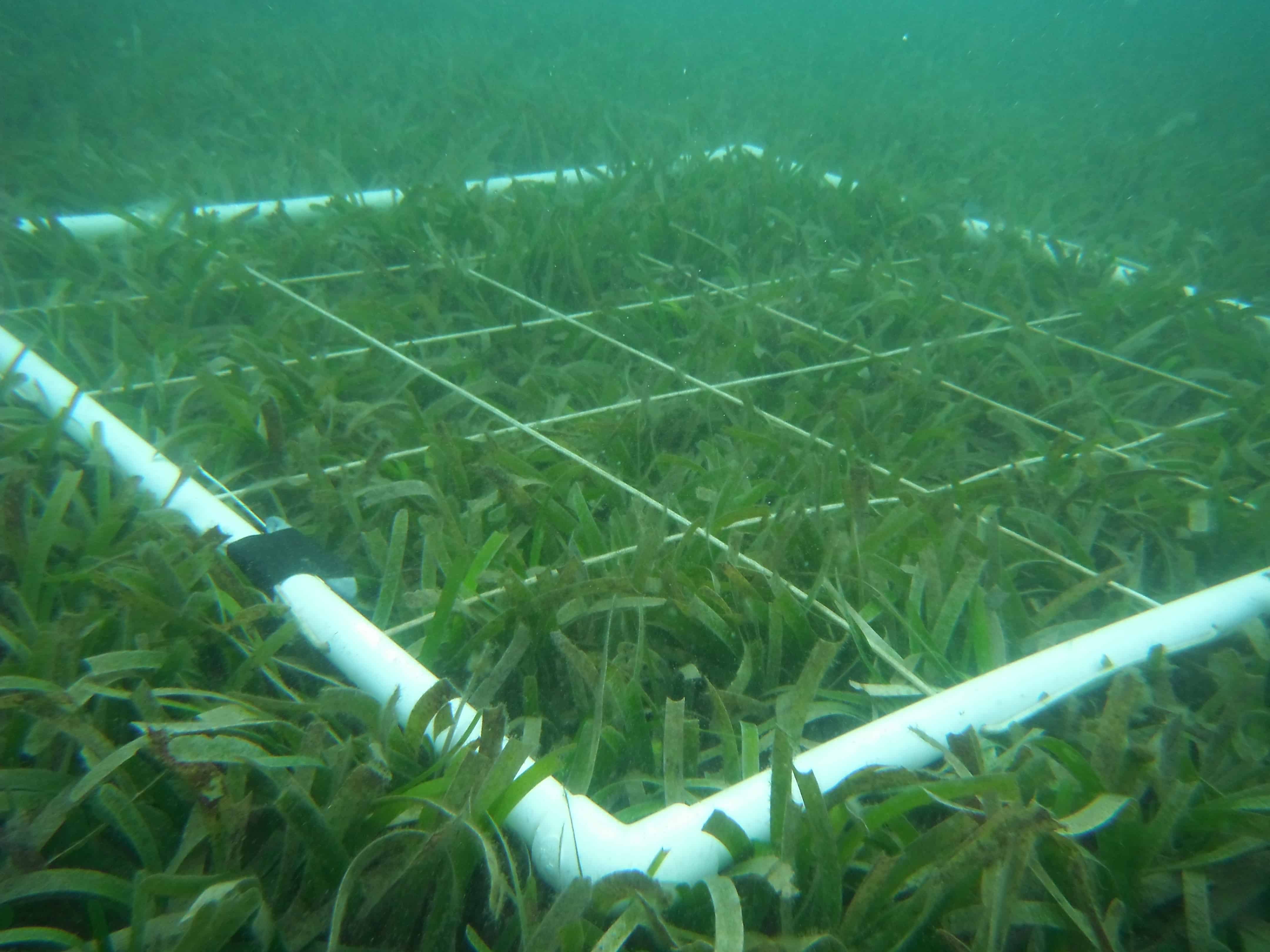
One metre square quadrats used during field assessments
Seagrasses are important to our ecosystems as they: oxygenate the water; regulate nutrients; stabilise sediments; protect shorelines by restricting water movements; and provide food for fish, invertebrates, green turtles and dugongs (Connolly, 2009). The complexity of seagrass habitat is increased when several species grow together, their leaves concealing juvenile fish, and benthic invertebrates such as crustaceans, bivalves and echinoderms (Hill, 2002). The health of seagrass patches is an excellent indicator of the health of inshore waters and early detection of change allows government agencies to adjust their management response to potential threats and pressures (McKenzie et al, 2010).
The study concentrated on seagrass habitats in Currumbin and Tallebudgera Creeks as well as the Nerang, Coomera and Pimpama Rivers and aimed to provide a comprehensive review of existing seagrass research and knowledge along with extensive field assessment and spatial mapping of habitats which will contribute to existing Ecological Inventory information and associated programs in South-east Queensland. The study also reviewed factors known to have an impact on seagrass health and abundance and provided a comprehensive monitoring program to fill key information gaps and provide direction for long-term monitoring. Such information will provide support for a range of natural resource management and planning applications such as:
- determining priorities for protection or rehabilitation of coastal ecosystems
- on-ground investment in coastal ecosystems
- local planning processes
- contributing to impact assessment of large-scale development
- the identification of coastal assets
- providing input to broader social and economic evaluation and prioritisation processes

Samples of Dugong grass (Halophila ovalis) showing varying epiphyte loads (increasing from left to right)
The methodology for this project began with initial mapping of seagrass patches using remote sensing from aerial imagery followed by field assessments which:
- assessed the accuracy of seagrass mapping
- assessed seagrass composition, cover and condition
- recorded a 3-5 minute narrated video detailing underwater marine biodiversity in the study area (to be used for education and capacity building)
- captured site photos which illustrated varying seagrass condition
These field assessments were followed up with validation of mapping and data collation which further refined mapping accuracy and established confidence levels for the resulting data. The final component of the methodology involved data analysis which then allowed for both seagrass patch extent and health to be quantified.
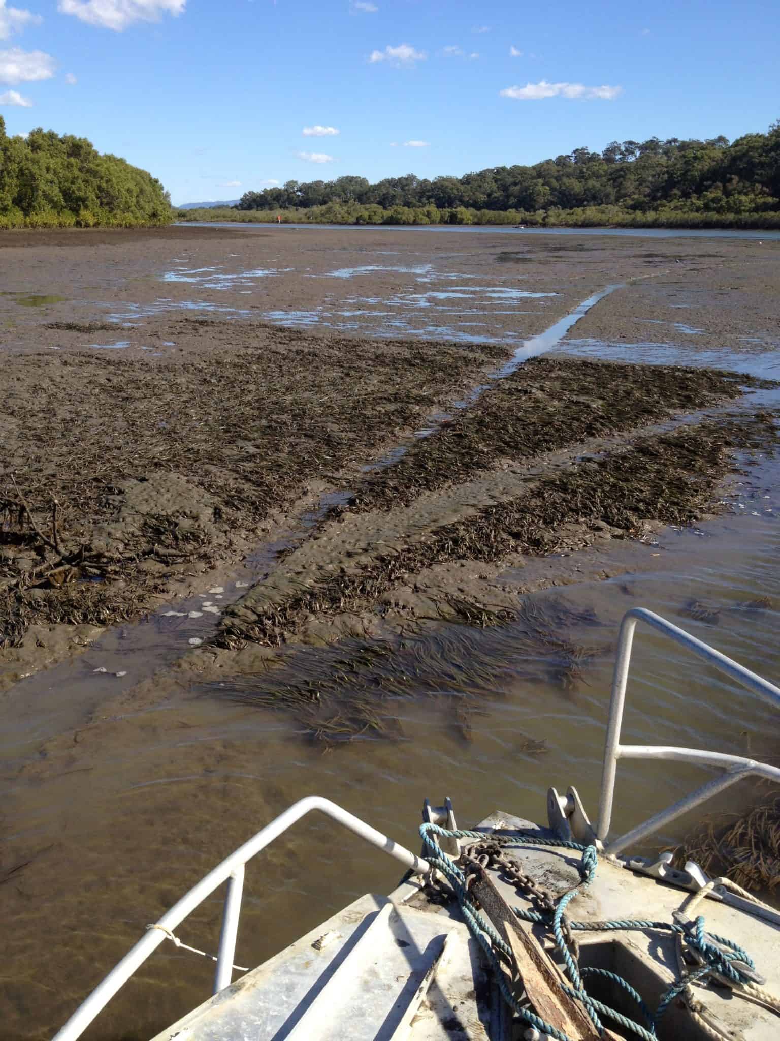
Exposed seagrass beds showing damage from
boats (‘prop scars’) in the Coomera River
The comprehensive set of data, maps and assessments that resulted from this study and was provided to council as part of the final report provides a significant baseline for future monitoring of seagrass health on the Gold Coast. Apart from information on the state of existing seagrass patches, locations, health, diversity and more, this report also assessed the extent and source of known and potential threats to the survival of this underwater plant community. This information can now feed directly into management planning of these Gold Coast waterways such that this important component of our estuarine environment may be protected into the future. If you would like more information on the seagrasses of the Gold Coast, take a look at this Gold Coast City link, factsheet or the Seagrass-Watch website.

A map extracted from the final report detailing potential threats to seagrass
patches in Currumbin Creek