Drone surveys – efficiency and accuracy!
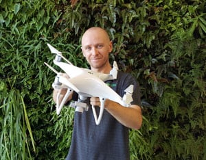
When it comes to mapping and monitoring an area’s environmental condition, there are various approaches to consider. Here at Natura Pacific we’ve found that using a drone is one of the most efficient and accurate survey methods around. This service allows us to provide you with a clear and detailed map of your area and an insightful analysis of all its attributes – perfect for any organisation planning a project that may impact environmental values.
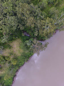 So what is covered by our drone environmental monitoring?
Using multi spectral imagery, your aerial survey can monitor and report on various key factors. Depending on your requirements, these might include:
- Topography / hydrology
- Classification and health of vegetation
- Proportion of vegetation coverage
- Landform changes
- Coastline analysis
- Establishing a baseline (e.g. to help with rehabilitation modelling)
- Eligibility for approvals and/or permits (e.g. for areas that you are planning to clear or disturb)
- Levy calculation.
Our survey drones are beneficial for a wide range of projects involving changes to the land. This service can assist you with monitoring and managing environmental concerns before, during and after construction takes place. Natura Pacific experts will help you interpret the drones’ findings, so you can pre-emptively handle any foreseeable issues or stumbling blocks.
Frequently asked questions about our drone survey capabilities:
How accurate are the drone surveys?
Our drones generally use normal GPS accuracy. This means our maps are accurate within 4-10 metres and will look similar to Google Earth images. Depending on your budget, we can also offer DGPS to further enhance the accuracy – right down to the centimetre level.
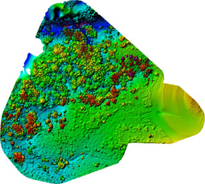 What format do you provide the results in?
It’s up to you! Just let us know prior to the survey which output(s) you would prefer from the following list:
- GeoTIFF / TIFF
- Textured 3D Model
- JPG
- DEM (DSM)
- Point Cloud (XYZ / LAS)
- Colourised Elevation
- KMZ for Google Earth (3D)
- NDVI Ag Processing
Can you stitch terrestrial-based imagery to the drone maps?
This isn’t possible to do in the bulk post-processing stage. We would suggest taking a 2D image from the drone footage and adding your terrestrial-based photos as individual ‘call-outs’ on this map.
What resolution are the images you provide?
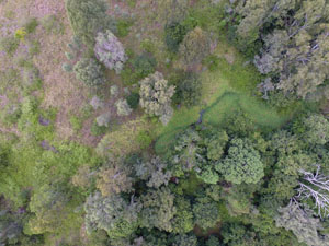 We usually provide a resolution of 2-4cm/pixel. However, for particularly small sites, we can get this down to as low as 0.7cm/pixel. Larger sites will generally be 4cm/pixel.
Whether you represent a government department or a private construction company, our survey drones can help you undertake building projects responsibly. Contact us today for more information – we can even provide you with a proof of concept if you wish!

