Natura Pacific

1300 318 720
  • HOME
  • CONSULTING
  • EDUCATION
  • PROJECTS
  • RESOURCES
  • ABOUT
  • NEWS
  • SPONSOR
  • CONTACT
0
Wednesday, 22 March 2017 / Published in Consulting, Videos

VIDEO: Natura is taking to the skies with drone mapping services

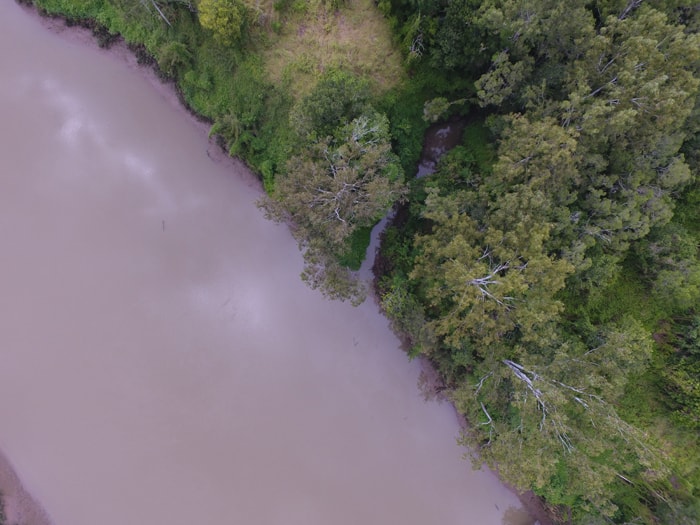
Have you ever wondered how drones could benefit your development proposal or project? Well, ponder no longer, because the Natura Consulting team now has two trained pilots of a brand new aerial drone that we have nicknamed ‘Libélula’ after the Spanish for ‘dragonfly’.

Using this drone we capture, in real-time, exceptional-quality aerial images which are far superior to many other available types of imagery and provide a significant advantage to our clients as they plan and carry out their projects. Take a look at the video below Natura’s Director Kieran Richardt explains more.

CLICK HERE TO CONTACT US AND FIND OUT MORE


Tagged under: aerial survey, drone services, drones, environmental consulting, natura consulting, Natura pacific, vegetation mapping

What you can read next

Natura Pacific features in ‘More Gold Coast’
Welcome to the New Age: how apps can help us to identify and conserve species
Natura-Pacific takes out UN Environment Award

Categories

  • Announcement
  • Back from the Brink
  • BushCam
  • Community
  • Consulting
  • Education
  • GroNative
  • Media
  • Nature Play
  • Resources
  • Sustainable living
  • Uncategorized
  • Videos
  • HOME
  • CONSULTING
  • EDUCATION
  • PROJECTS
  • RESOURCES
  • ABOUT
  • NEWS
  • SPONSOR
  • CONTACT
© Natura Pacific | All rights reserved.
Natura Pacific Header logo

In all aspects of our work at Natura Pacific, we will strive to provide an ecologically sustainable future for generations to come.

1300 318 720
info@natura-pacific.com

NATURA PACIFIC ~ HQ

2/55 Dover Drive Burleigh Heads, QLD, 4220 Gold Coast, Australia

Open in Google Maps

BCorp w Tag
GroNative
CEnvP-Logo
Social Traders Logo
SNN logo
TOP