Mangrove Health Mapping
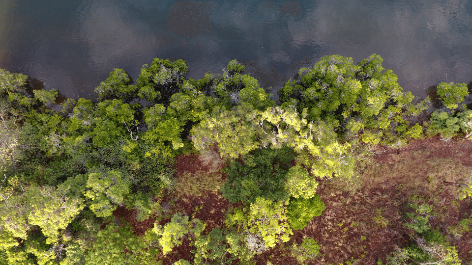
In 2017, Natura Consulting provided services to 4 Elements Consulting at the remote site of the Skardon River in Cape York peninsula where a large new bauxite mine was being developed for the extraction and export of this raw mineral through the mouth of the Skardon estuary ecosystem. We provided 2 CASA-certified RPA pilots to the area where they conducted 2 weeks of aerial mangrove health monitoring surveys using our company drone. The surveys included obtaining clear aerial photography of 8 mangrove monitoring sites to determine mangrove foliar cover and photosynethetic potential. This was done using a specialised NIR and NDVI camera fixed to the drone body. Detailed visual and systematic quantitative analysis was then conducted of over 10 million pixel data points to determine the baseline cover and photosynthetic health of these important vegetation communities. This baseline data and report is now being used to benchmark conditions over time through the mine life-span to ensure no significant reduction in cover and health of the mangrove ecosystems along the estuary.
- PARTNERS 4 Elements Consulting
- YEAR2017
- SECTORResource Extraction & Primary Industries
- CATEGORY Consulting , Drone , Ecology , Environmental , Recent